John Arnold: A journey of just over a mile, but scarcely a yard of it without a story

It was just that ‘in between’ time of an early October evening - not yet black dark but just a bare chink of light away in the west.
In reality, I shouldn’t have gone that far at all. If I’d turned in our own boreen, I’d have come ’bout half a mile. But I drove on, just checking now and then on the mileometer on the van until I came to the top of the Old Road - a few hundred yards over the mile… but it got me thinking.
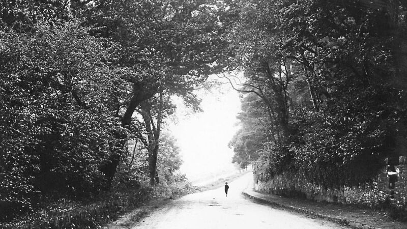
The Golden Mile is in Leicester in England - there are many theories about its name. The Green Mile is a famous ‘prison’ film - not easy viewing but a great film nevertheless. That ‘strong’ mile from the chapel to the ash tree is a typical Irish country road.
Down from the village, through the School cross, and then up, up rising ground until after the shanawalla. Fairly level then and after the next turn it’s descending again to the stream and then back climbing again.
Do you know the Golden Mile and the Green Mile have their own unique story to tell, but every mile is the same. Patrick Kavanagh in his poem Epic wrote:
Me too, I thought as I drove back home from my motorised perambulations!
In truth, we’re not sure when the chapel in the village of Bartlemy was built. It was definitely there in the 1840s. In really ancient times there were places of worship at Desert, Killamurren and Gortroe. The latter was a Catholic church until the Reformation.
A decade or more back, when a major renovation was being done on Bartlemy Church (we had Mass in the Hall then), some of the really old building features of the walls were revealed. At the time some seemed to go with the idea that the edifice might originally have been a mill - but then, what good was a mill on top of a hill and no water around!
Fr Maurice Kennefick and his successor in the Parish, Fr Edmond Barry, are both buried within the Church.
The building is in the corner of our Chapel Field. The now picturesque, white-washed house near the church wall was once the home of Tailor Spillane and his family.
When the Spillanes were gone, the house was idle for a while - the Ahern family lived there for a term when their house/shop across the road from the church was being re-roofed.
Down the road on the left was the Path Field, so called because the old Mass Path ran across the field. Many of the older generation told me, maybe 40 years ago, how the people came across the fields from Ballyogoha, Ballinure and Desert to worship every Sunday morning. On shanks mare, they’d come to Ballinwilling Bridge, then in along the path to the Blessed Well, up along captain Connells ‘double ditch’ and out our Path Field.
There was a stile on the roadside - we always used it as children. I’d say the last time that old Mass path was used was in the late 1970s or early 1980s.
The first real turn on the road is Cuneen na Sprioda - the Corner of the Ghost or Spirit. Before the roads were tarred they were ‘sheeted’ with stones broken by hand by local stone-breakers. Here and there along the real old roads were little corners where stones from the quarry were dumped.
The painstaking work of breaking the stones was done with a tiny little hammer - I think I have one or two. Pad Roche worked as a stone-breaker, wearing two pairs of glasses to protect the eyes from stone splinters.
Long ago, of a windy dark night, we’d hurry past ‘the Cuneen’ - two old trees were intertwined and when the wind was high, the creaking timbers made a frightening sound.
Another story concerns the funeral procession of a local woman. As the coffin bearers came down around this little turn, well, whatever move one of them made, he stumbled and the coffin fell to the ground. The lid came off and the jolt was enough to ‘wake up’ the ‘dead’ woman - apparently, much to the disgust of her overly hen-picked husband!
Locals told me that ‘the next time she died’ they took her to the cemetery by a different road!
Seventy-five yards below the Cuneen was another little ‘cummer’ where the stone-breaker sat and plied his trade.
Our boreen takes a sharp turn to the left into the haggard - originally, it went straight down and into the ‘old yard’. Strangely enough, there was only ever the one farm in our townland of Garryantaggart - the Priest’s Garden.
Down the steep little hill to the bridge, river and crossroads - on the right hand side built into the hillside an old Lime-kiln can still be seen. Our field behind it still bears the name kiln filed - pronounced ‘kill’ field.
When we were young, the bridge over the river Cnapog was a narrow, curved structure. Dave Ryan, who collected the churns of milk in a tractor and trailer, knocked the bridge several times - accidentally or intentionally, I don’t know!
Eventually, in the mid-1960s, Mr Jack Giltinan, the County Council Roads Engineer, was fed up rebuilding the bridge!
In the 1830s, when the first Irish Ordnance Survey Map was published, there was no crossroads here - just a road on up the hill towards Cronovan. A small bit up that road on the left were about a dozen houses - long since returned to the earth.
In the 1840s, the New Line was constructed as one of the many Famine Relief Schemes and this cut across the older road. thus resulting in the cross of four roads that we have today.
A National School for the Bartlemy area was opened in Monananig townland in September of 1847 - ‘Black ’47’. This served the parish until the early 1900s.
Just up the hill from the crossroads, a site for a new school was acquired from Batt Ahern in Hightown townland. Coffeys of Midleton were the contractors and the ‘New’ School opened in 1904.
I knew up to 20 people who had gone to the Monanig School in the 1890s - truly, the light of other days.
The road levels off then near the shanawalla - this probably meant the ‘seana baile’ or old homestead. It was where an ancient path crossed the road with a style at either side.
In the early 1900s, when the famed Dungourney hurler Jamesy Kelleher took on and beat the gentry in a point to point horse race, the horses crossed the road here - Billy Barry told me he stood by the ditch as a child and watched the runners and riders participating in that epic contest.
On the road a few hundred yards on the left can still be seen a fine circular ‘lios’ or fort - supposedly a ‘convent’ of sorts was situated here perhaps a thousand years ago.
Down below then to Ned Carey’s bridge and the old sheep-dipping tub. The road rises a bit and forks - right, up the hill is steep. To the left is the ash tree, the Old Road and the quarry where Mick Geary was killed in 1946 - ach sin sceal eile.
A journey of just over a mile, but scarcely a yard of it without a story.


 App?
App?


