Potential storms to hit Ireland at New Year followed by sharp cold snap

Tomas Doherty
A series of potential storms could pass directly over Ireland during New Year celebrations, forecasters have warned.
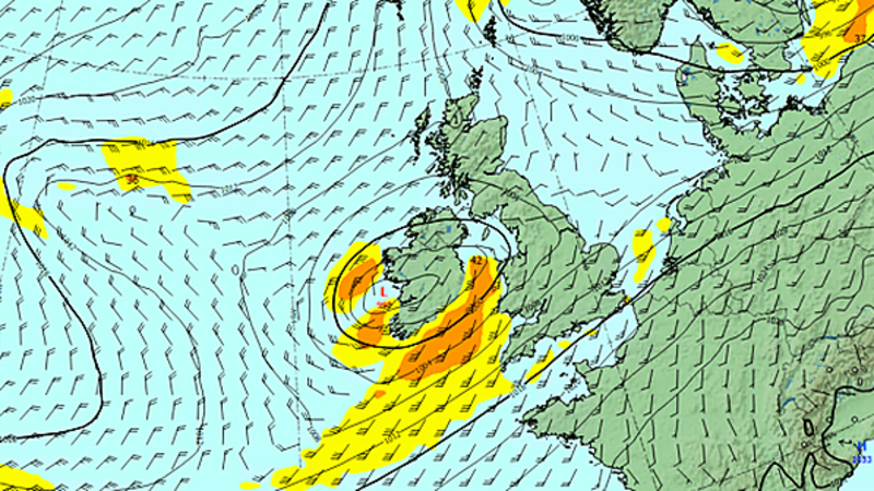
Met Éireann said low pressure centres are currently developing out in the Atlantic, the first of which is expected to pass over the country on Tuesday, which is New Year's Eve.
Another more significant area of low pressure will hit Ireland on Wednesday (New Year's Day), according to the weather agency.
A status-yellow rain warning will be in place in Donegal from 11am on Monday for 24 hours, while a warning for strong winds will be in place during the early hours of Tuesday in Donegal, Galway and Mayo.
The UK Met Office has issued a separate warning for strong winds on New Year's Eve for counties Antrim, Armagh, Derry, Down, Fermanagh and Tyrone.
Met Éireann said forecasters were closely monitoring the situation, with further updates likely over the coming days.
New Year's Eve is expected to be a very unsettled day with heavy rain moving over the country.
Met Éireann meteorologist Mark Bowe said there would be "significant winds to the northwest but rain will be widespread and rather heavy at times too which could lead to spot flooding."

He said the weather on New Year's Day will prove to be a lot more significant, with more rain and very strong and blustery winds for all areas.
"We are currently tracking the development of the low pressure system expected for Wednesday with potentially some very impactful winds across western and southern areas," he said.

For now the weather system looks set to track right across the island with significant winds expected for western and southern areas.
Met Eireann’s flood forecasting centre warned that soils are saturated or approaching saturation countrywide, which will increase rainfall runoff to the rivers.
The centre said the widespread and prolonged nature of the rain may lead to significant river level increases, while there is also the potential for surface water flooding.
Significant surge, wind and wave conditions are expected due to the beginning of spring tides. Exposed low-lying coastal areas may experience wave overtopping due to strong on-shore winds coinciding with high tide.
Later next week, forecasters are predicting a sharp change in the weather, with very cold northerly air set to sink down across the country.
Temperatures are likely to fall well below freezing overnight and struggle to remain in the single figures during the day.


