Cork Weather: 'Another potential storm coming on Sunday'

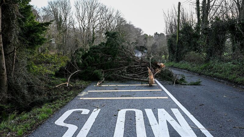
Tree blocks Road near the Gaelscoil in Carrigaline. Picture Chani Anderson
Founder of Ireland’s Weather Channel and a climate scientist at UCC, Cathal Nolan told : “Cork avoided the worst of the stormy conditions on Thursday night, with Kerry and upwards directly along the coast taking the brunt of the violent winds, as well as areas in the Midlands.
“It was a very significant storm. There were winds of about 120-125km/h recorded in Cork, which brought with them fallen trees, [and] disruption to power services and public transport.
“We saw record-breaking wind strength in Ireland. Some independent weather stations in Clare recorded winds up and over 190km/h, breaking the previous record of 182km/h in Limerick in 1945, so it was phenomenally strong,” he said.
He explained another reason Cork saw less damage than elsewhere in Ireland. “Some parts of Cork, the coastal areas, would be more accustomed to winds than places like the Midlands and Ulster; the infrastructure is better prepared,” said Mr Nolan.
“There’s another potential storm coming on Sunday.
“We are looking at a deep area of low pressure, not as strong winds but still in excess of 110km/h.
“This storm will see the worst conditions centred in Kerry and coastal areas of Cork.”
This morning could see some patchy frost.
It will be dry at first with some sunny spells but a band of showery rain will move in from the west later in the morning.
Sunshine and scattered showers will follow from the west through the afternoon, some of hail with a chance of isolated thunderstorms too.
Highest temperatures of 4 to 7 degrees.
Southerly winds will increase fresh and gusty for a time, stronger in western coastal parts, but ease again later.


 App?
App?


