Cork weather and traffic: Frost and icy patches in places as temperatures set to drop later

Cloud will start to move in from the south and southwest later, with highs of 5C to 9C during the day before scattered showers come in.
Friday will be a cold start with widespread frost and icy patches in places before it starts to gradually clear, bringing a dry day with sunny spells.
Cloud will start to move in from the south and southwest later, with highs of 5C to 9C during the day before scattered showers come in.
It will be another cold night on Friday with lows between -1C and 4C.
Saturday then will be a cloudier day overall with occasional bright spells at first. It will be mostly dry to start with a few light showers, but outbreaks of rain and drizzle will push into the southwest through the afternoon. It will feel milder with highs of 8C to 12C.
Rain will then spread eastwards to all areas on Saturday night, becoming patchier by morning with lows of 4C to 8C.
Traffic seems fairly settled on Friday morning, with parts of the city centre seeing some congestion.
The N20 is seeing some delays, as well as Dennehy's Cross.
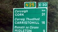
Road sensors on the M8 and the N25 have recorded a road surface temperature of between 1C and 2C. Ice may be present on untreated roads, especially on higher and shaded routes. Please take care.
Sunday will start dull, with patchy outbreaks of rain and drizzle. It will start to brighten up through the afternoon with sunny spells, with highs of 8C to 12c.
It will stay mostly dry and clear overnight on Sunday; however, scattered showers will affect Atlantic coastal regions, with lows of -1C to 4C.
Looking into next week, Monday will be a cold day with frost and ice slow to clear. It will be dry in most places with sunny spells, and highs of 6C to 9C.
Tuesday will be cloudy and wet, with rain coming in from the southwest during the morning, possibly turning into sleet on higher ground at first. Highs of 5C to 9C are expected.






 App?


