‘Challenging conditions expected’: Crisis management team convene ahead of storm
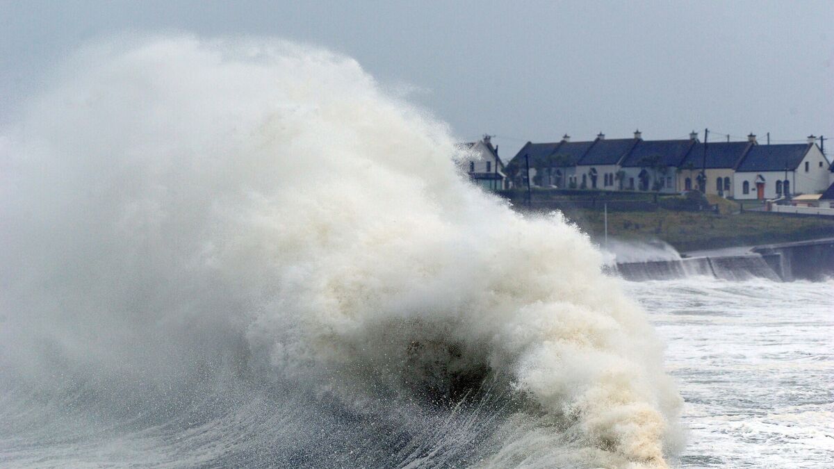
Huge waves pounding the shore at Garrettstown, Co. Cork, during a recent storm. An orange warning will be in place in Cork tomorrow.
Power outages, very difficult travel conditions, coastal flooding and fallen trees are among the likely potential impacts from Storm Kathleen when she makes landfall tomorrow.
Kathleen has been described as a “significant” low-pressure system and is expected to bring strong southerly winds and damaging gusts across the country on Saturday.
An orange wind warning has been issued for Cork as well as Kerry, Waterford Galway and Mayo while a nationwide yellow warning is in place from early tomorrow.
However, experts have warned that as Storm Kathleen is a dynamic system, there may be updates to the warnings.
This morning, the National Directorate for Fire & Emergency Management (NDFEM) Crisis Management Team convened a Met Éireann technical briefing to assess the possible impacts from the storm.
Speaking after the meeting, Keith Leonard, National Director of the NDFEM said that given the "challenging wind conditions expected", he would urge members of the public to stay away from all coastal areas for the duration of the Met Éireann warnings.
“Also, strong winds can make driving conditions hazardous – especially for the more vulnerable road users such as cyclists, pedestrians, motorcyclists and high sided vehicles – and road users should pay particular attention to the risk posed by fallen trees and flying debris.
“Importantly, I would remind people that it is critical that they never ever touch or approach fallen wires. Be sure to stay safe and stay clear of fallen or damaged electricity wires and, if you encounter any, do contact ESB Networks at 1800 372 999. Where power cuts do occur, use the PowerCheck App to check for reconnection times.
“We will continue to monitor the ongoing weather conditions and ensure that all relevant state bodies are responding appropriately to meet any challenges. I would advise everybody to keep up to date with information regarding the developing weather situation via the Met Eireann platforms available.”
The public is urged to be aware of the latest forecasts via Met Éireann’s social media channels, www.met.ie and the Met Éireann app.
The team has issued the following advice:
- The public is advised to stay away from coastal areas during this period. The Irish Coast Guard are appealing to people to “Stay Back, Stay High, Stay Dry”.
- Strong winds can make driving conditions hazardous, especially for the more vulnerable road users such as cyclists, pedestrians, motorcyclists and high sided vehicles.
- Road users should pay particular attention to the risk posed by fallen trees and flying debris.
- There is a potential for tidal flooding in coastal areas. In addition to this, the storm may also bring localised heavy showers, which in turn may lead to surface flooding in urban locations.
- People are advised to prepare for the arrival of the storm including ensuring their mobile phone is fully charged to enable communication.
- Never drive through flooded roads, the depth of the water can be deceiving.
- ESB Networks is highlighting the dangers posed by fallen live wires and is advising the public and the emergency services to stay away from these fallen cables and to report such cases to it immediately. ESB Emergency Services can be contacted at 1850 372 999. The public can monitor www.PowerCheck.ie in regards to power restoration times.
The NDFEM Crisis Management Team continues to monitor developments, liaising with Local Authority Severe Weather Assessment Teams and Crisis Management Teams who are actively monitoring the evolution of the storm.






 App?
App?


