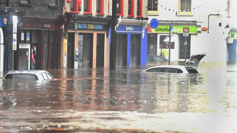
Data gathered in Cork during Storm Babet could be used to help predict future flooding risks

Flooding on Main street Midleton during Storm Babet. Picture: Eddie O'Hare.
DATA gathered during flooding in east Cork during Storm Babet could be used to help predict the extent of future flooding and ensure that damage is limited.
That is according to researchers involved in CeADAR, Ireland’s centre for Applied Artificial Intelligence (AI), who are using AI and satellite technology to develop an early warning system for Irish communities at risk of severe flooding.
The researchers are using data collected by the European Space Agency’s Sentinel-1 satellite to map flooding in multiple communities, including Midleton, to predict the extent of future flooding events, which they say has an accuracy of up to 20 metres.
Funded by the Department of Enterprise, Trade and Employment, and Enterprise Ireland under the Disruptive Technology Innovation Fund, the flood prediction model forms part of CAMEO, a €9m project led by UCD to develop an Earth Observations (EO) services sector.
Implications
Director of Applied Research at CeADAR, Dr Oisín Boydell, said that the project has major implications for communities in areas at high risk of flooding in Ireland.
“We’ve witnessed extensive flooding across the country in recent times and, with increasing greenhouse gas emissions certain to lead to more rapid climate change, we can expect even more intense precipitation events in the future,” he said.
Speaking to The Echo, Dr Boydell said that Midleton was an area of particular focus in developing the project and “it’s been particularly impactful from a perspective on the ground [as] there’s been a huge amount of damage and disruption caused.”
He added: “The floods during Storm Babet is an example that we were able to then map and monitor as it happened with satellite technology, which gave us very good real-time information.
“We would like to think that there would be really good inputs into those plans based on more accurate data produced by this tool, that could be very valuable into that planning process and make those plans and mitigation measures better.”
Online platform
Dr Boydell explained that the AI model would be implemented via a new online platform that’s looking at using EO data to warn local councils and emergency services up to 48 hours in advance of flooding events, providing them with time to take emergency measures to limit damage to homes and businesses, evacuate residents, and protect livestock.
“We have developed the research, we’ve tested the approach, we validated that this AI model is really accurate, and it’s currently being developed on this CAMEO platform.
“This could be a user interface that makes it very easy for a non-technical kind of end user to understand that information and to provide those kinds of alerts.
“The CAMEO project in its current phase is running up until the end of this year and then at that stage there will be a good prototype [that] we hope would progress very quickly.”
Cost
In 2023, the Irish Fiscal Advisory Council warned that extreme flooding events resulting from climate change could cost the State around €500m annually by the end of 2030. However, models such as the mapping tool CeADAR is developing could aid in preventing widespread financial strain caused by flooding devastation.
“This tool is, I think, a really good example of the positive societal benefits of using AI technology because there is a lot of fear about the unknown aspects of AI,” Dr Boydell said.


 App?
App?


