Cork’s coast as you’ve never seen it before

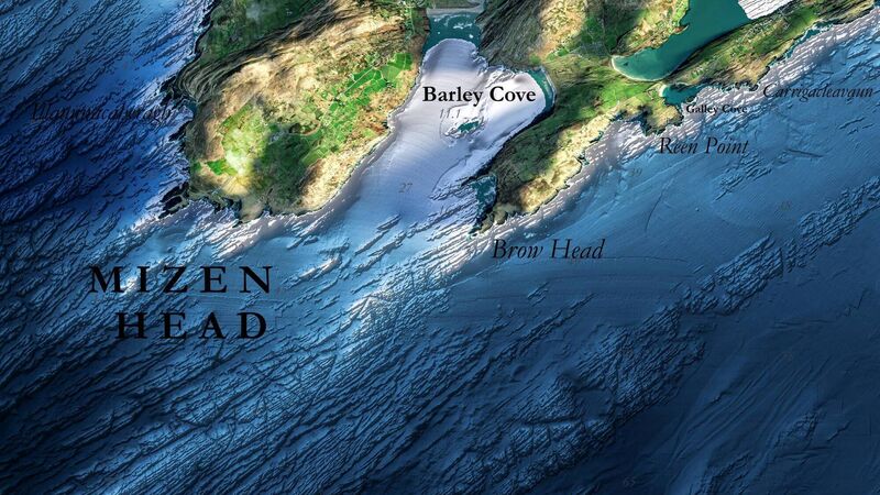
Mizen Head from the INFOMAR Blue Scale Map Series.
The second of a new series of high-res maps, offering unprecedented views of Cork’s coastline will be released today and will feature the Mizen area.
The Blue Scale Map series, a collection of 18 high-resolution maps of Ireland’s coastal waters, has been produced by the INFOMAR (Integrated Mapping for the Sustainable Development of Ireland’s Marine Resource) programme.
INFOMAR was established in 2006 and is funded by the Department of the Environment, Climate and Communications.
Featuring the Beara Peninsula to Mizen Head, and from Cape Clear to Roaringwater Bay and Cork Harbour, these new high-resolution maps highlight the unique and intricate landscapes that lie beneath the waves.

Ireland’s coastline is approximately 3,171km in length and boasts some of the most dynamic marine environments in Europe.
Each week, INFOMAR will be releasing a new map of a different section of the Irish coastline.
County Cork boasts a coastline of approximately 1,200km, and the latest published in the new map series is the Blue Scale maps of Bantry Bay, which was published last week, and Mizen Head, which is available today.
Mizen Head is traditionally regarded as the most southerly point of mainland Ireland, although Brow Head is the actual southernmost point, even if it does only beat Mizen Head by nine metres.
The headland’s Irish name, Carn Uí Néid, means “cairn of Néid’s grandson”. This refers to Balor, a leader of the Fomorians, a group of malevolent supernatural beings in Irish mythology.
One of the main transatlantic shipping routes passes close by to the south, and Mizen Head was, for many seafarers, the first (or last) sight of Europe.
To the south, the Fastnet Rock lighthouse, Ireland’s Teardrop, was the last landfall seen by many emigrants to America and one of Marconi’s first telegraph stations.
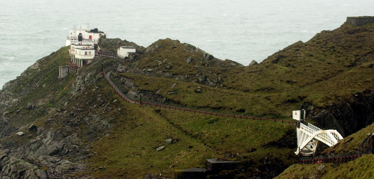
Mizen signal station holds an important part in the history of safety at sea communications.
In 1931 the station became home to the first radio beacon in Ireland. Over time, the technology at this site expanded to include wireless signals, Racon, GPS and DGPS.
The coming three weeks will see maps featuring Roaringwater Bay, Galley Head and Cork Harbour, each one revealing the brilliant marine geology and unique seafloor across the Cork coastline.
All of the maps will be free to download on infomar.ie.
The third of the Blue Scale Map series will be released next Friday and will feature Roaringwater Bay.


 App?
App?


